
Family-centric venue offering a rock shop with vibrant minerals, gem digging & indoor mini golf. Service options: In-store shopping Address: Dido Valley Rd, Simon's Town, Cape Town, 7995 Hours: Open ⋅ Closes 4:45PM Health and safety: Mask required · Staff wear masks · Staff get temperature checks · More details Products and services: scratchpatch.co.za Phone: 021 786 2020
Chapman's Peak Dive
Posted on Wed June 20, 2018.

Chapman's Peak
Chapman’s Peak is named after John Chapman, the Captain’s mate of an English ship, the Consent. The peak which looms overhead was not named after a governor or brave mountaineer, but a lowly ship's pilot. In 1607 the skipper of the British ship Contest found his vessel becalmed in what is now Hout Bay and sent his pilot, John Chapman, to row ashore in the hope of finding provisions. The pilot later recorded the bay as Chapman's Chaunce (chance) and the name stuck, becoming official on all East India charts.
History of Chapman’s Peak Drive
Chapman’s Peak is named after John Chapman, the Captain’s mate of an English ship the Consent. The peak which looms overhead was not named after a governor or brave mountaineer, but a lowly ship's pilot.
· Chapman’s Peak is named after John Chapman, the Captain’s mate of an English ship, the Consent. The peak which looms overhead was not named after a governor or brave mountaineer, but a lowly ship's pilot. In 1607 the skipper of the British ship Contest found his vessel becalmed in what is now Hout Bay and sent his pilot, John Chapman, to row ashore in the hope of finding provisions. The pilot later recorded the bay as Chapman's Chaunce (chance) and the name stuck, becoming official on all East India charts.
In the early 1920’s Sir Nicolas Fredrick de Waal, first administrator of the Cape Province, ordered the construction of a high-level road linking Cape Town with the Southern Suburbs. The roadway (De Waal Drive) was extremely well received. Enthused with this success he called for another road linking Hout Bay to Noordhoek. Two possible routes were under consideration in 1910. The route over the low nek between the Chapman’s and Noordhoek Peaks was second to the more spectacular route along the vertical sea cliffs.
In 1914 preliminary surveys on the road got under way. Surveying the route was a scary business. The cliffs and ravines were steep, rotten and unstable, and at times the surveying party was on all fours as they investigated the perpendicular terrain. The route over the nek appeared to be no better; and the project appeared to be expensive and a ‘mission impossible’. De Waal however, would not take no for an answer and eventually he ordered the ‘go ahead’ for along the cliffs which appeared, at the time to be the better option.
The road was cleverly planned with the road surface based on the solid and conveniently located 630 million year old Cape Granite contour, while the many roadside cuttings would be carved out of the more workable Malmesbury series sediments.
In 1915, with the use of convict labour supplied by the newly formed Union Government, construction began from the Hout Bay end, and in the following year work began from Noordhoek. The first portion of the road to the Lookout was opened in 1919.
This spectacular roadway took seven years to complete, at a cost of ₤20 000. The Hout Bay - Noordhoek Road ‘hewn out of the stone face of Sheer Mountain’ was opened to traffic on Saturday 6 May 1922 by the Governor of the Union of South Africa, His Royal Highness Prince Arthur of Connaught.
In 1962 a section of the road was widened, and in 1977 a portion of road was washed away, and subsequently the road was closed on 14 May, after a large section was washed away and the damaged section was replaced by a bridge at a cost of R150 0
Further Reading
Scratch Patch Mineral World and cave golf
Thu March 17, 2022
Read This Article

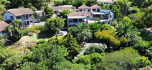
Hout Bay Retreats and Events
Thu May 6, 2021
Read This Article
Victorskloof Lodge is proud to present Victorskloof Retreats. Situated high on the slopes over looking the picturesque Hout Bay Valley, The setting is a secure and tranquil. An ideal location for you to host your own retreat or be a participant in the wide range of retreats on offer.

SHAMBA TRAVEL AND TOURS.
Sun September 27, 2020
Read This Article
THE TWO ICONIC SOUTHERN AFRICAN DESTINATIONS: CAPE TOWN AND VICTORIA FALLS. AFTER THE CAPE, EXPLORE ZAMBIA & BEYOND WITH SHAMBA TOURS Lets us take care of all your travel arrangements at Victoria Falls, throughout Zambia and the neighbouring region. We also offer best value flight and car hire booking services worldwide. Our services include: Safaris All types of accommodation Flights Vehicle hire Group bookings Incentive tours and more We offer personalized service...
Share This Post